

ATLAS TO ACCOMPANY THE OFFICIAL RECORDS OF THE UNION AND CONFEDERATE ARMIES. Published Under the Direction of the Hons. Redfield Proctor, Stephen B. Elkins, and Daniel S. Lamont, Secretaries of War
(Washington: Government Printing Office, 1891-1895).
SCARCE IN ORIGINAL FOLIO PARTS AND AN EXTREMELY IMPRESSIVE ATLAS PRODUCED BY THE UNITED STATES GOVERNMENT PRINTING OFFICE TO ILLUSTRATE THE OFFICIAL RECORDS OF THE AMERICAN CIVIL WAR. The first of the 36 fascicles contains the index and preface and also included is the 1902 additions and corrections insert, each of the following 35 fascicles contain five of the large double page plates.
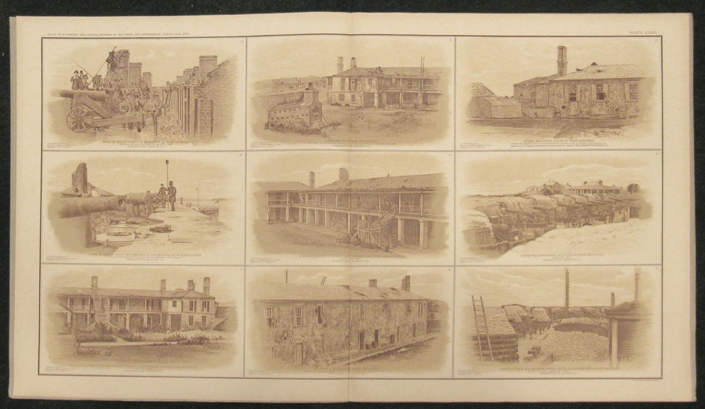
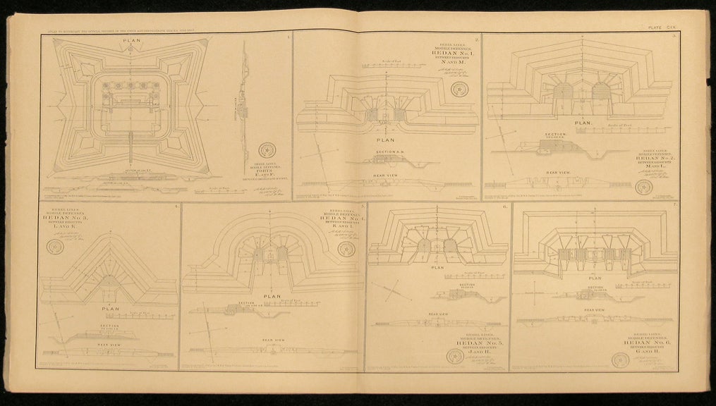
A beautiful and fascinating accompaniment to the official records of the Civil War. Each massive plate is either an impressively detailed and informative map or contains multiple images providing detailed plans of cities, towns and fortresses, views, panoramas, uniforms, battlefields, bridges, engagements, lookouts, etc., etc.
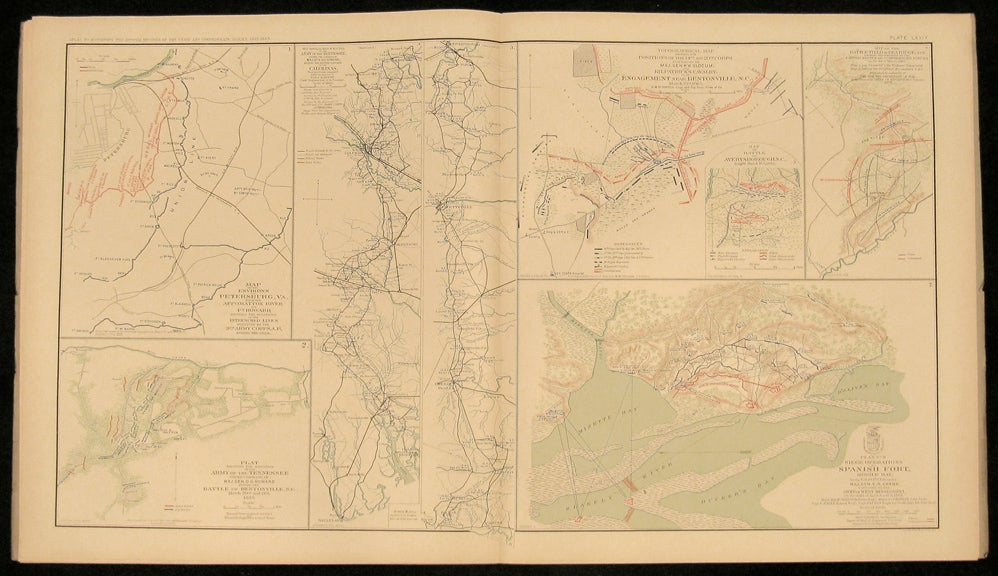
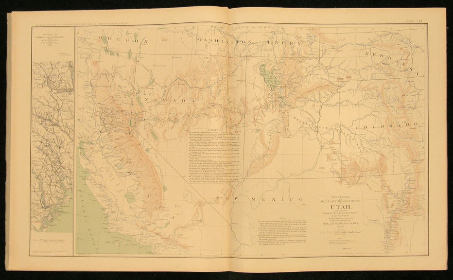
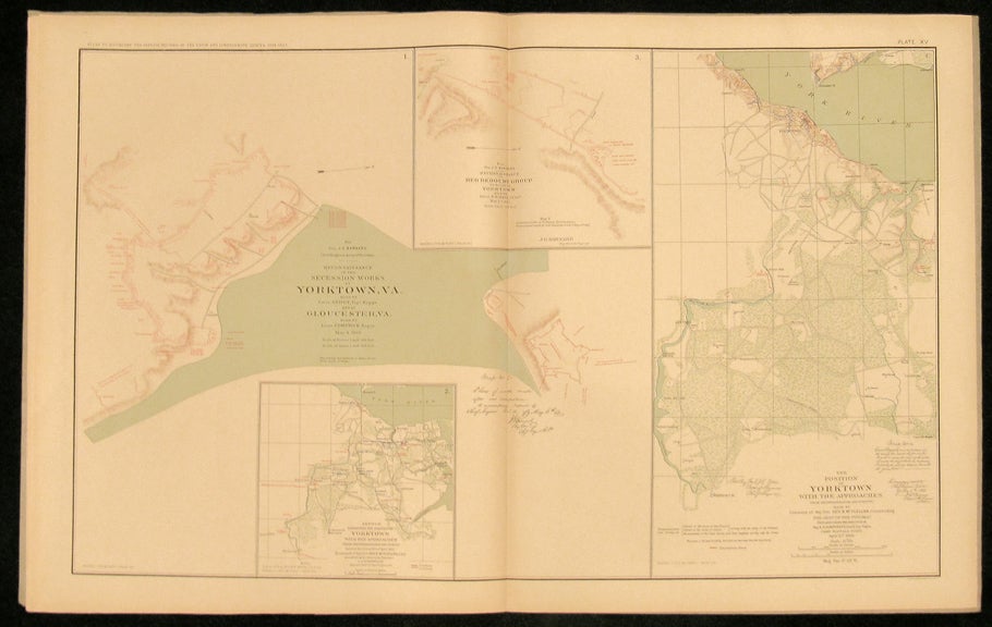
The maps and plans were primarily reproduced from those that had been drawn during the war by engineers, draftsmen, and sometimes even generals themselves for actual military use. Only a few maps, drawn later by cartographers, were added for historical purposes. Tactical and strategic maps indicate troop disposition; defense lines, redoubts, and fortifications of key sites are clearly shown. Terrain maps often contain picket positions, signal stations, and lines of march. Some were taken from what had been only rough sketches, some from cartographic masterpieces. All are informative and reveal the knowledge, or lack of knowledge, that both sides possessed about the terrain, and the strength and the position of opposing troops. The index to the maps refers to campaigns and battles, rivers, creeks, lakes, bays, islands, bridges, fords, ferries, landings, roads, railroads, mountains, towns, churches, forts, and much more.
An indispensable source of information and imagery from the American Civil War. The atlas was not reprinted until 1958. Item #26210
In the original 36 parts. FIRST EDITION. With 175 numbered double-page lithographed color maps and plates on 178 sheets by Bien. Large elephant folio, presented in the original 36 large folio fascicles with their original printed paper wrappers, now housed together in a blue cloth portfolio case with string ties, the spine of the case is lettered in gilt. A handsome and impressive set in fully original condition, overall, very excellent and especially well preserved. The original wrappers show some occasional minor wear along the edges and spines, occasional small tears at folds or minor creasing or separation. Sets in the original fascicles with wrappers intact are very rare and very elusive in the open market. This is a very fine example of the most rare state of the first edition.